Drawing Tools

The ability to draw accuate and complex boundaries is the cornerstone to any great mapping program. That’s why we have meticulously developed powerful set of Drawing Tools to handle any unique mapping situations that may arise. Below you will find a brief description and an example of use of those Drawing Tools.
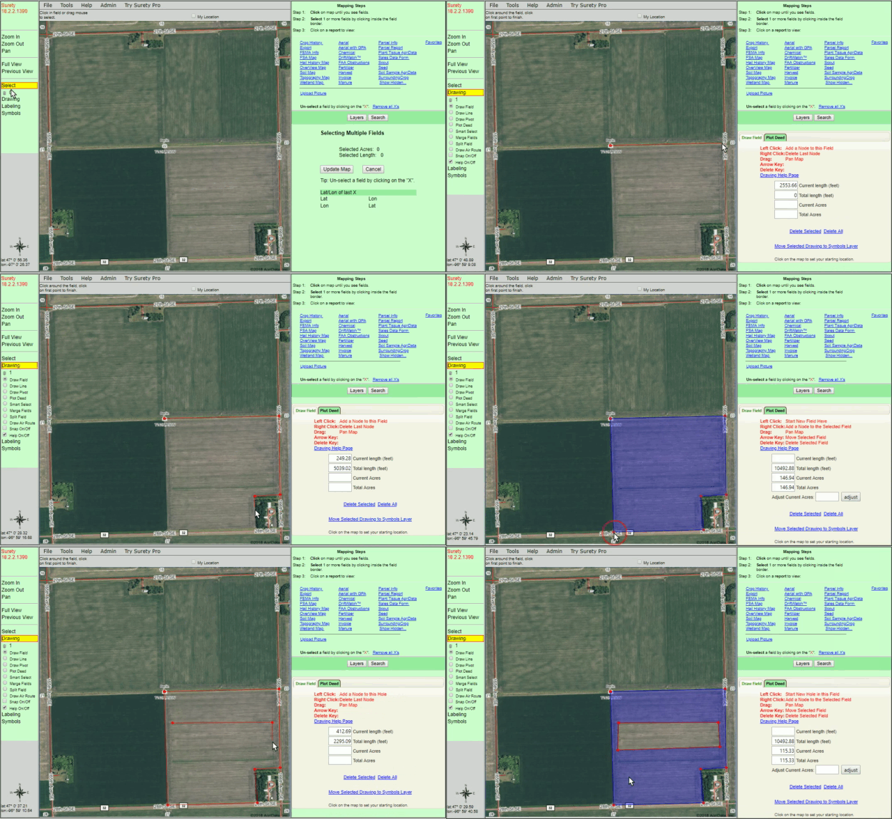
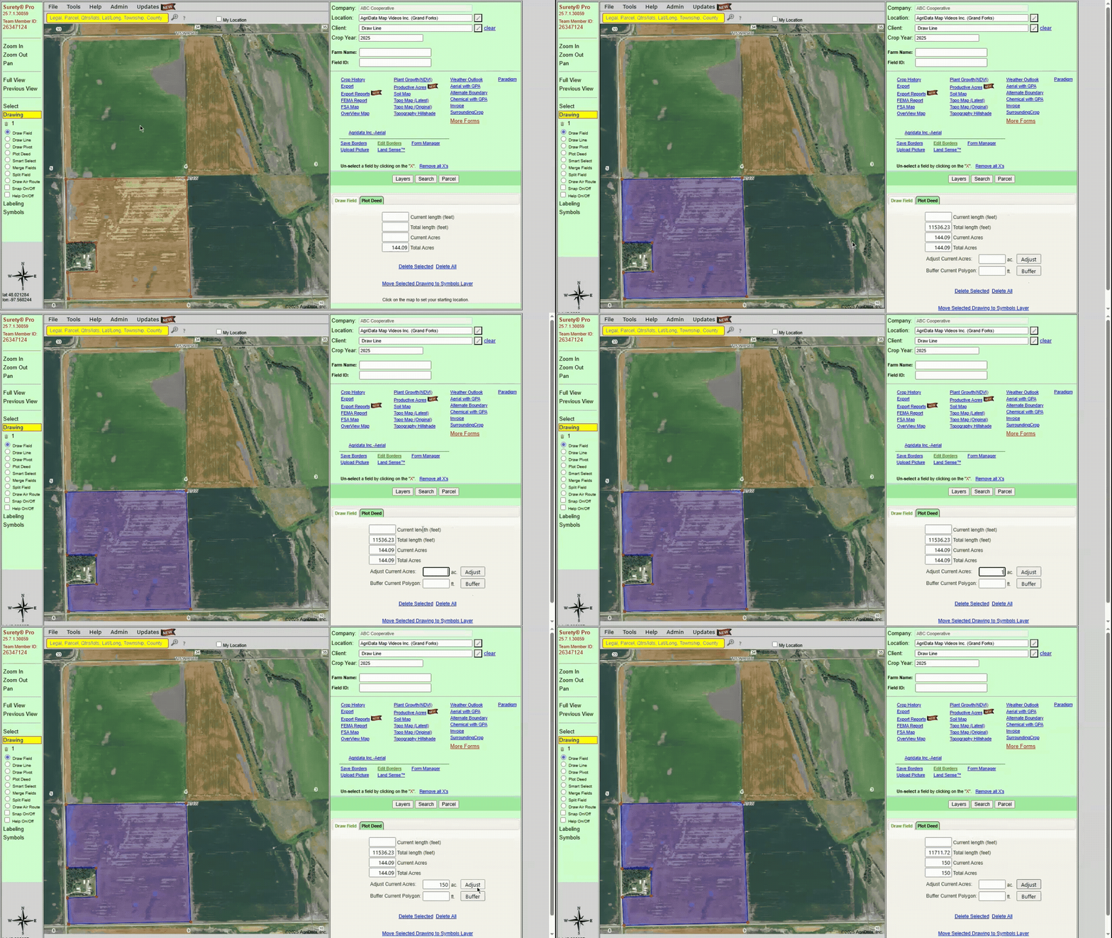
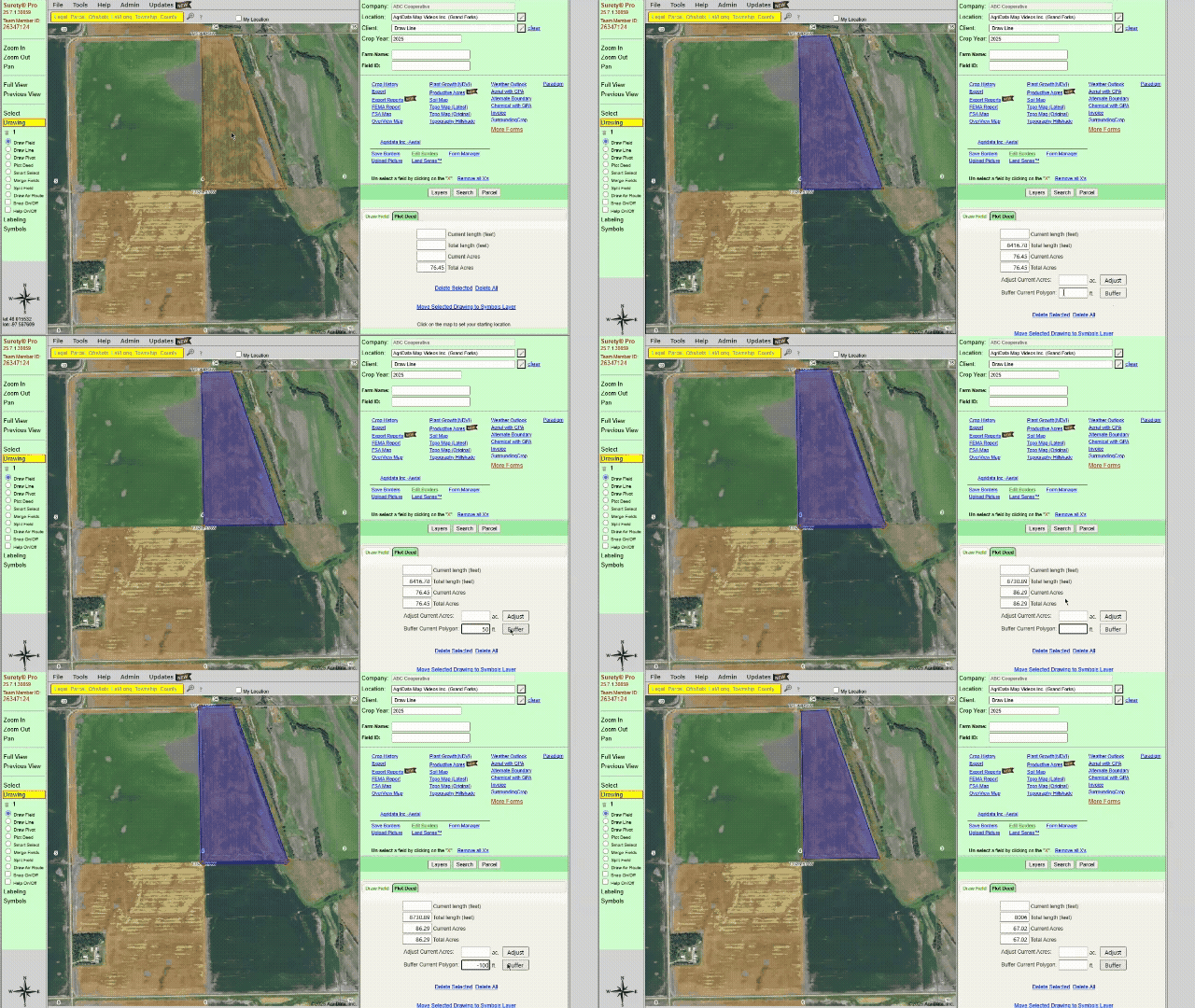
Easily define a polygon boundary with the Draw Field tool. Add, remove, or move points (nodes) on your polygon to create an accurate boundary and precise acreage calculation. The Draw Field tool also has the function of creating exclusions within a polygon to subtract that area from its acreage calculation.

Draw Field Example

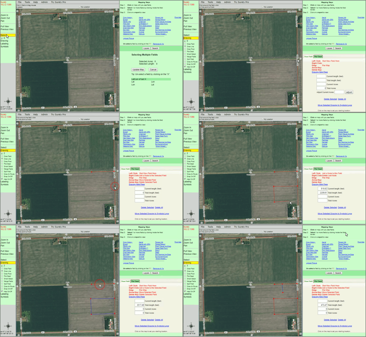
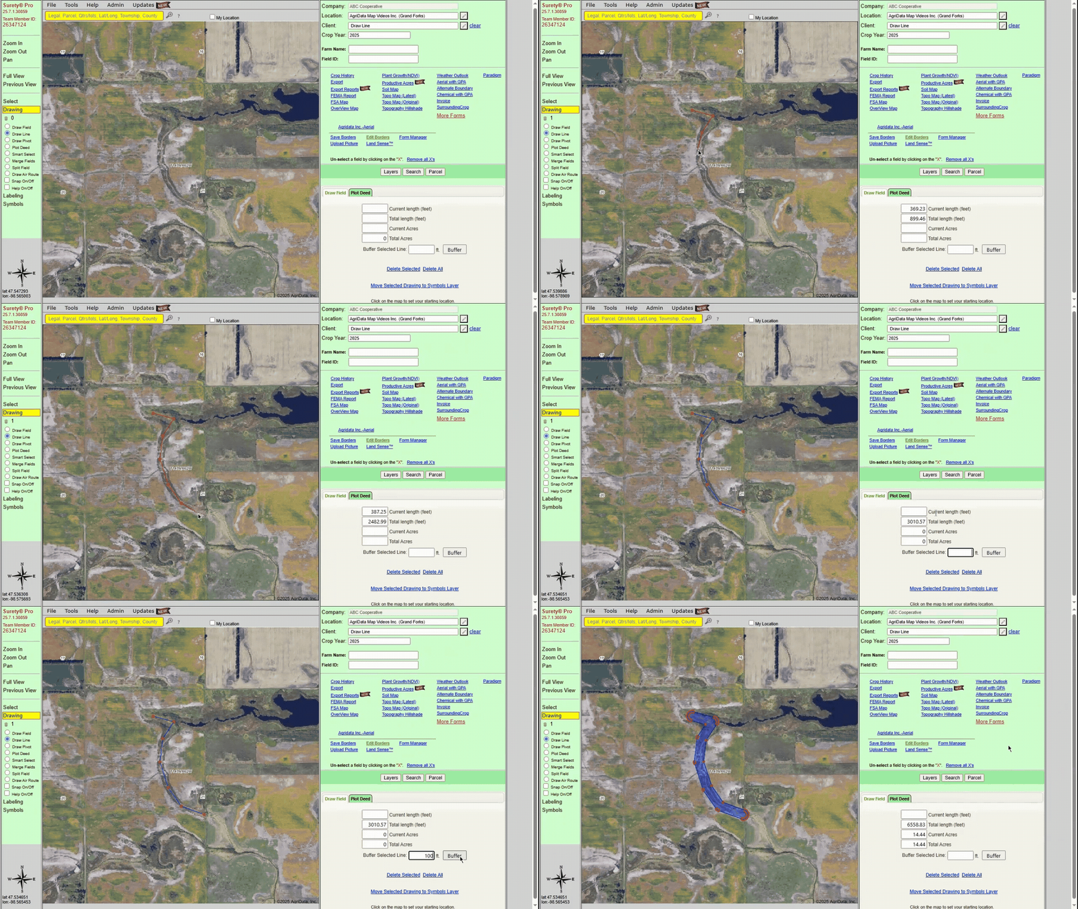
Determine distance between 2 or more points on the map. Display the distance in feet when generating a map or form.

Draw Line Example

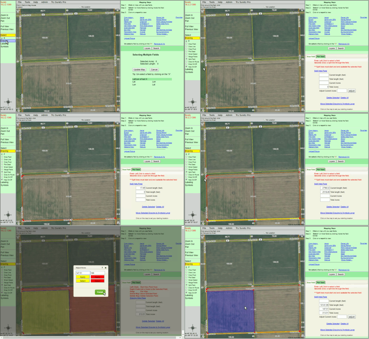
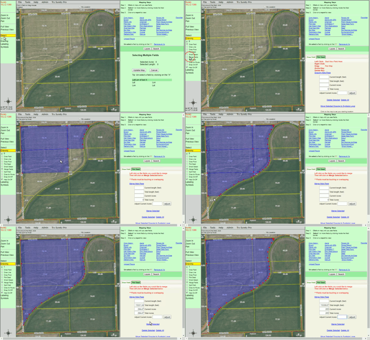
The Merge Field Tool provides a quick way of merging two or more boundaries into one. Merge either FSA field borders or custom drawn borders to combine the acreage into one total amount.

Merge Fields Example

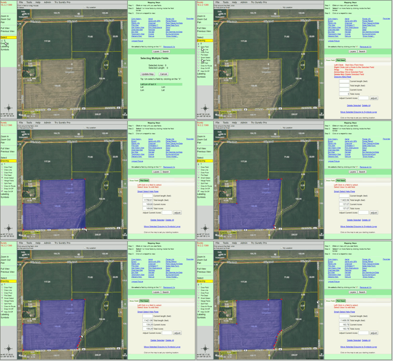
Use of the Smart Select tool to instantly create drawn borders for the FSA boundaries that are able to be modified quickly and easily. The Smart Select tool is also used to modify any previously saved boundaries within a Surety® Pro account.

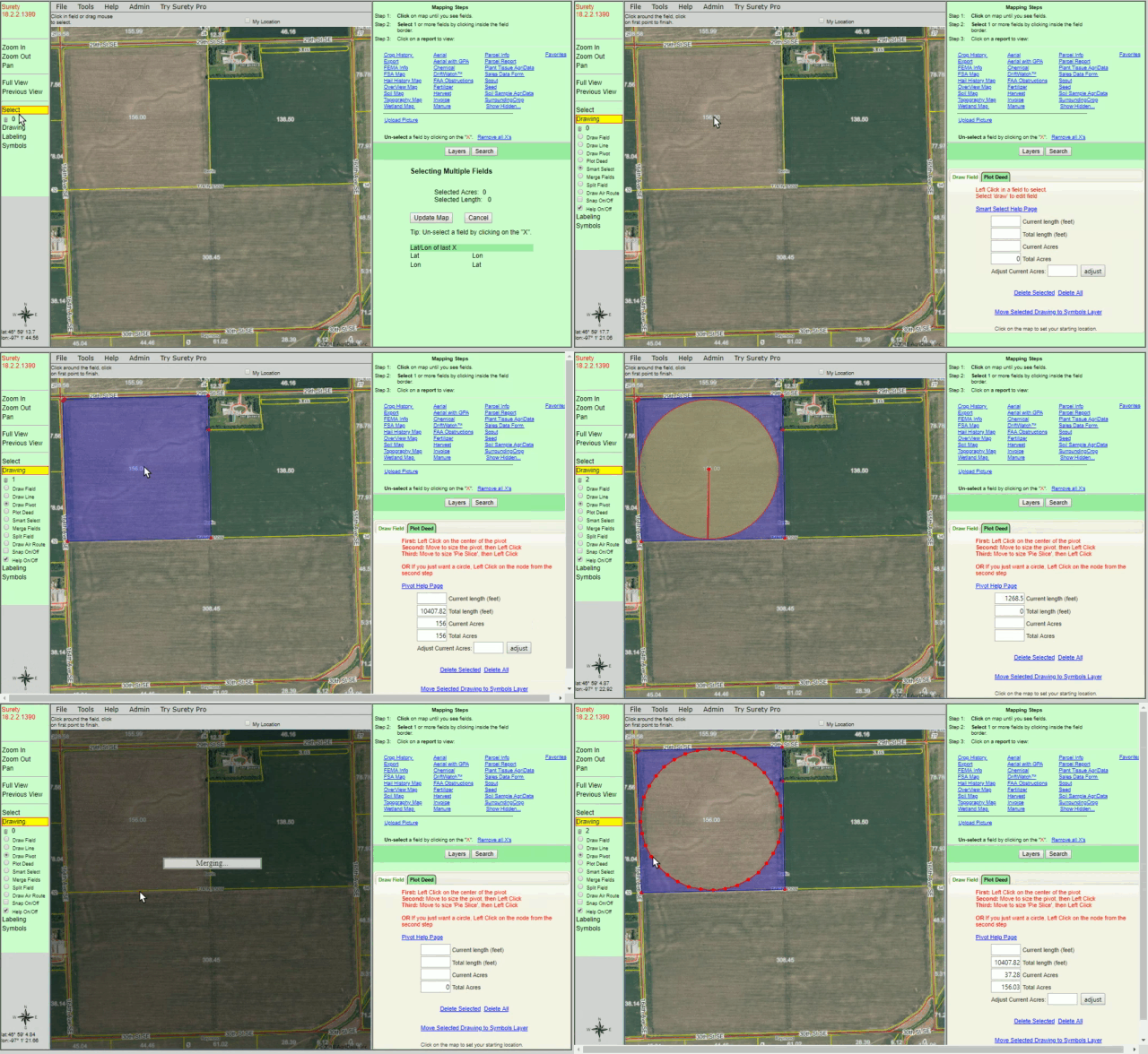
Drawing out a pivot by hand can be a tedious and inaccurate process. The Pivot drawing tool makes quick work of determining size and acreage of a pivot placement. This tool will also determine the acres of the non-irrigated corners of a pivot.

Pivot Example

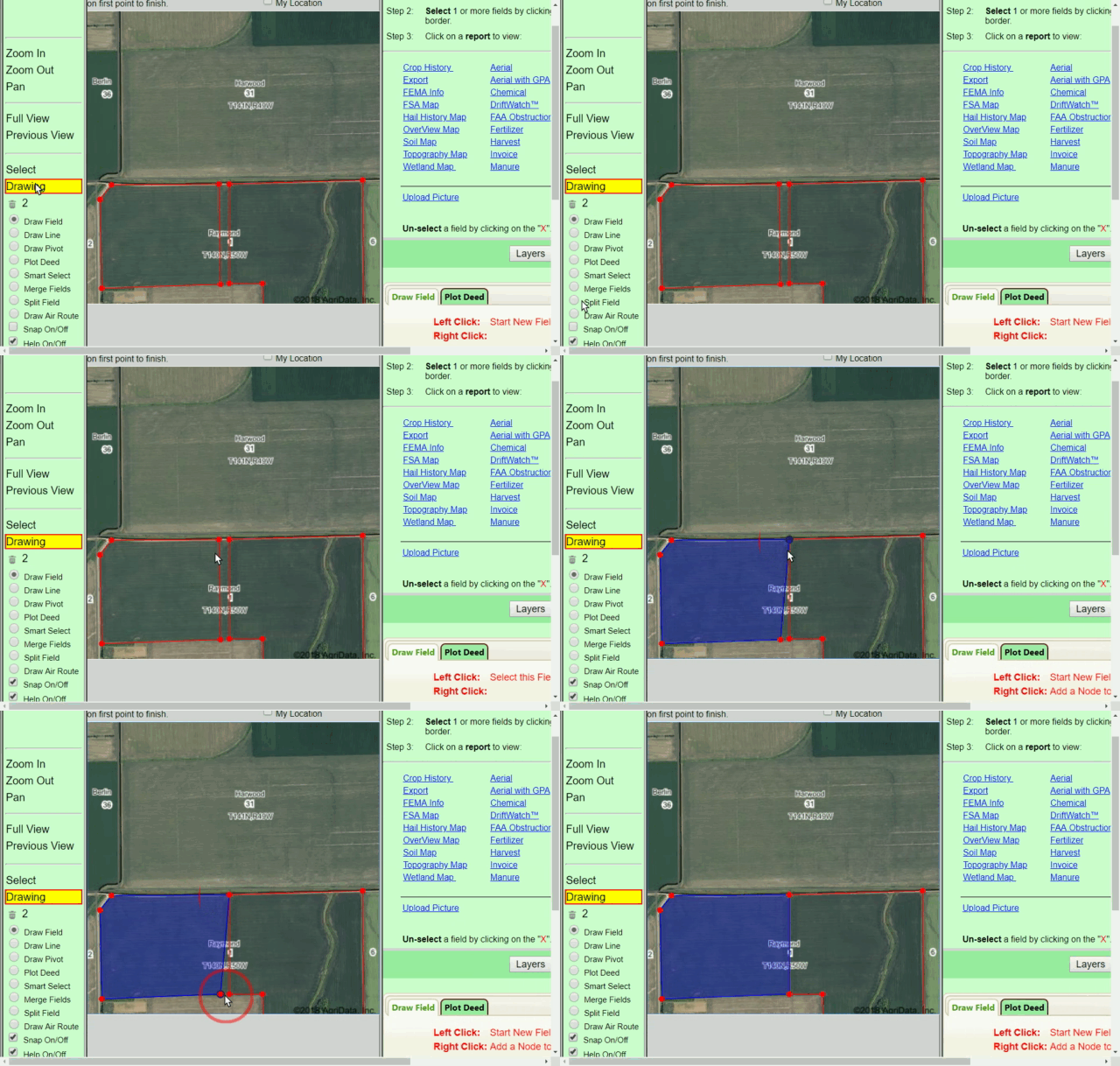
The Snap feature enables two boundaries to automatically “snap” together to eliminate any gaps or overlaps between the two boundaries.

Snap Example


For more information, please Contact Us directly.